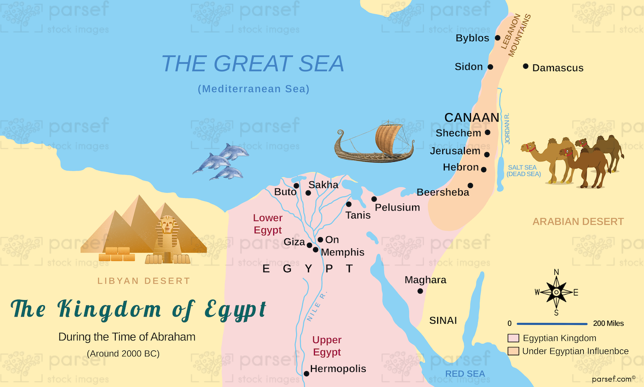
Egypt During Abraham’s Time Map
- This map depicts the geographical landscape of Egypt during the time of Abraham, highlighting key locations and regions mentioned in the biblical narrative.
- It provides a visual understanding of the environment in which Abraham and his family resided during their sojourn in Egypt.
- The map may include features such as major cities, the Nile River, and significant pharaonic sites.
Download High Resolution 300 DPI File Egypt During Abraham’s Time Map