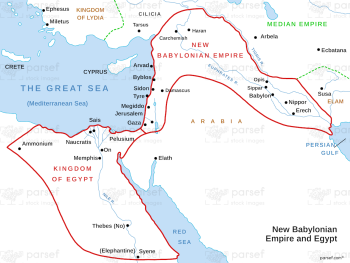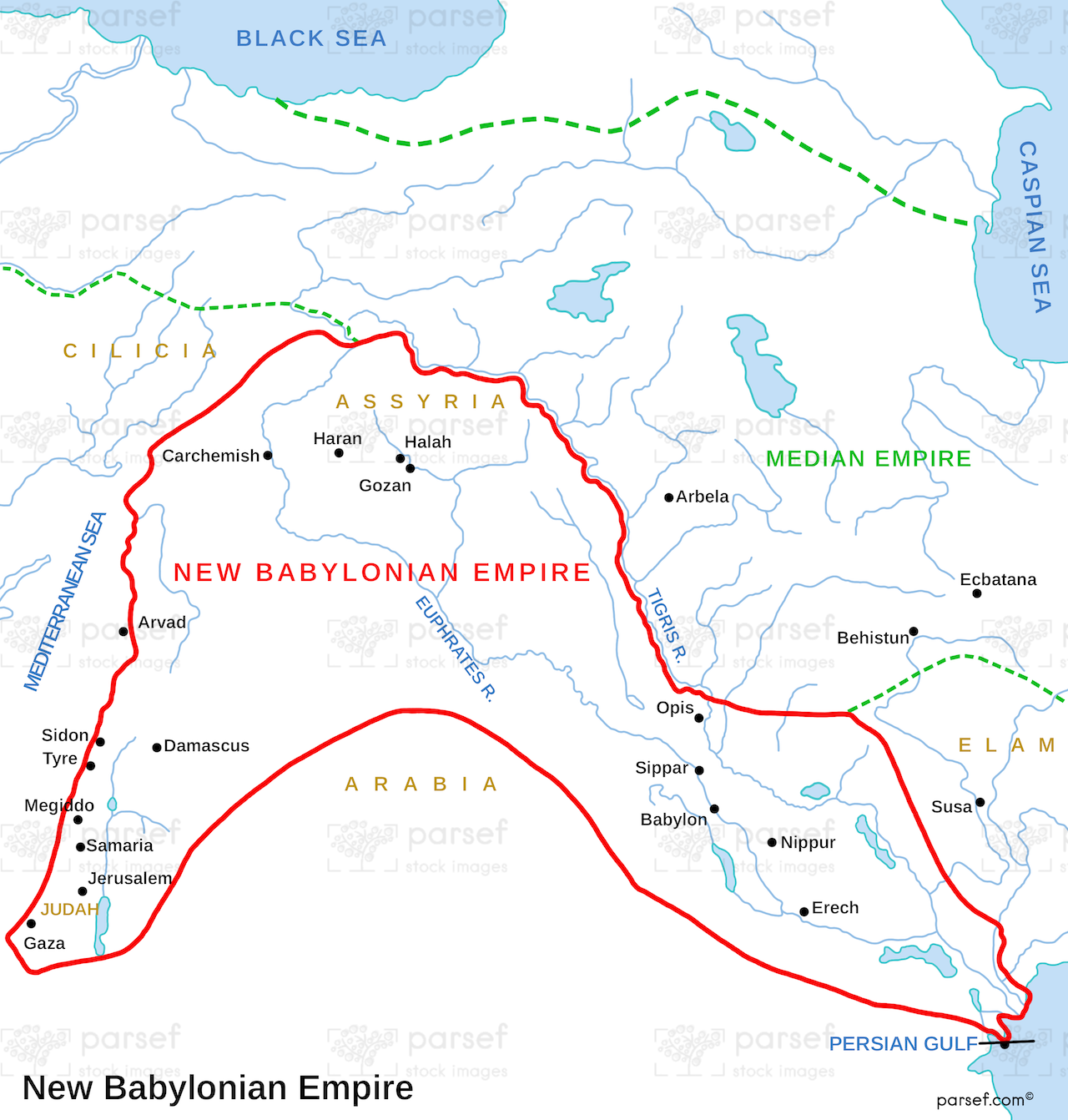
Daniel New Babylonian Empire Map
- This map depicts the extent of the Neo-Babylonian Empire, highlighting its capital city of Babylon and other significant regions under its control.
- It provides a geographical framework for understanding the historical context of the Book of Daniel, where the Israelites were exiled to Babylon.
- The map may illustrate the vastness of the empire and its strategic importance in the ancient world.
Download High Resolution 300 DPI File Daniel New Babylonian Empire Map