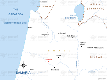
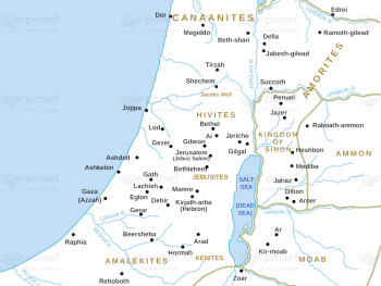
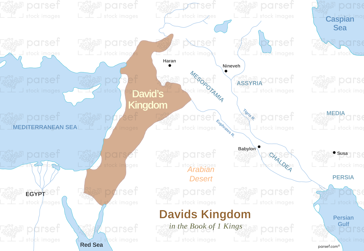
David’s Kingdom Map

David’s Kingdom Map image

David’s Kingdom Map

  • This map illustrates the territorial extent of the kingdom of Israel under the reign of King David.
  • It showcases the significant territorial gains achieved through military conquests, highlighting the rise of Israelite power.
  • The map may include conquered territories, vassal states, and important cities within David's kingdom.

Download High Resolution 300 DPI File David’s Kingdom Map


Related Maps

Amos Judah Map image
Read More

Amos Judah Map

Amos Judah Map: Depicting the region of Judah during the time of the prophet Amos, this map highlights significant locations...
Read More

Zorah Map image
Read More

Zorah Map

Zorah Map: Focused on the ancient city of Zorah, this map highlights its location and significance. Zorah is notable for...
Read More

Exodus from Egypt Map image
Read More

Exodus from Egypt Map

Exodus from Egypt Map: Illustrating the route of the Israelites’ Exodus from Egypt, this map highlights significant locations and events...
Read More

Ancient Nubia Map image
Read More

Ancient Nubia Map

Ancient Nubia Map: This map depicts the region of ancient Nubia, including significant cities and geographical features. Nubia is notable...
Read More

Kingdom of Jeroboam Map image
Read More

Kingdom of Jeroboam Map

Kingdom of Jeroboam Map: Highlighting the kingdom of Jeroboam, this map shows its territorial extent and major cities. It provides...
Read More

Exodus Red Sea Map image
Read More

Exodus Red Sea Map

Exodus Red Sea Map: Depicting the route of the Exodus, this map highlights the crossing of the Red Sea and...
Read More