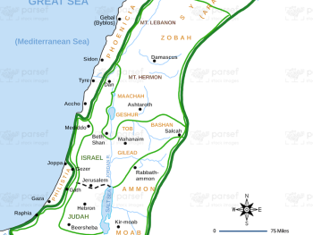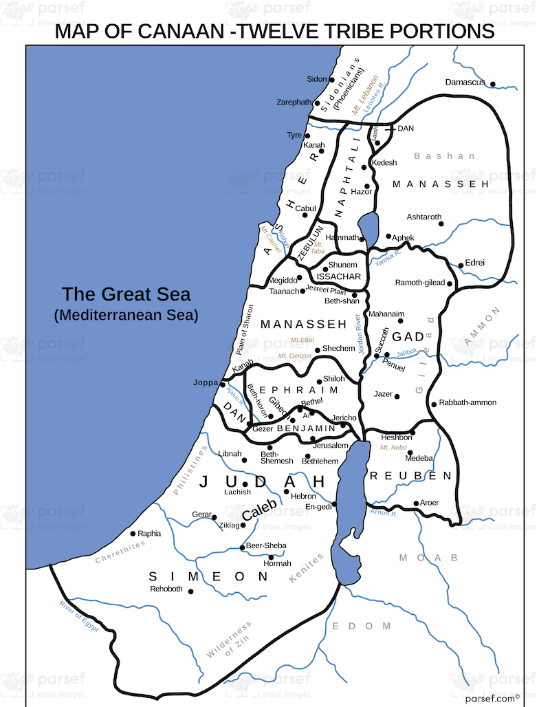

Canaan Twelve Tribe Portions Map
- This map outlines the territorial divisions of the twelve tribes of Israel after they conquered and settled in the land of Canaan.
- It demonstrates how the land was allocated among the tribes, reflecting the biblical account of the inheritance process.
- The map may highlight the boundaries of each tribe's territory, major cities within those territories, and potentially significant geographical features.
Download High Resolution 300 DPI File Canaan Twelve Tribe Portions Map