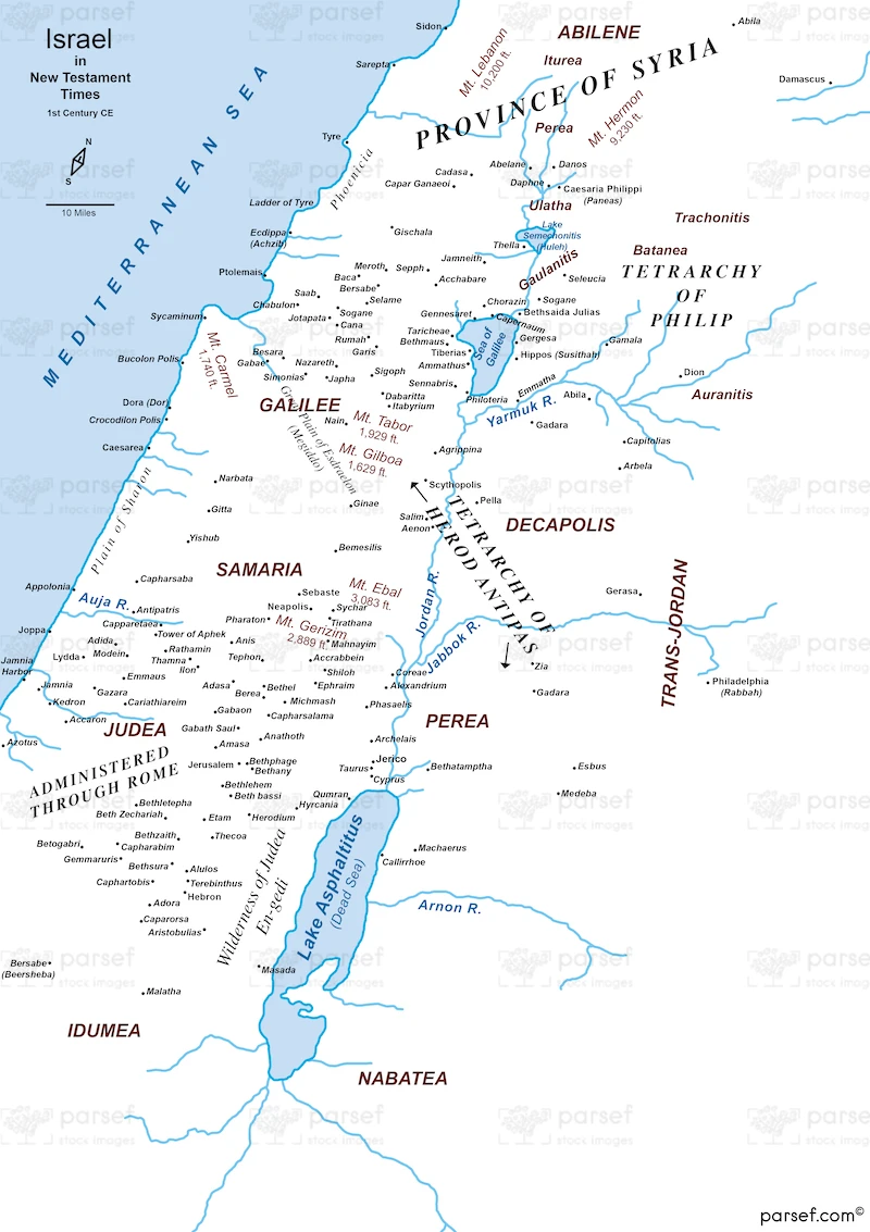
Israel in New Testament Times – 1st Century CE – Basic Map – 300Dpi


Related Maps

Exodus Mount Horeb Map image
Read More

Exodus Mount Horeb Map

Exodus Mount Horeb Map: This map shows the route to Mount Horeb (Sinai) during the Exodus, highlighting key locations and...
Read More

Syria at its Height Map image
Read More

Syria at its Height Map

Syria at its Height Map: Highlighting Syria at its peak, this map shows its greatest territorial extent and important cities....
Read More

Assyrian Empire Map image
Read More

Assyrian Empire Map

Assyrian Empire Map: Depicting the Assyrian Empire at its height, this map shows its territorial extent and major cities. It...
Read More

The Red Sea Map image
Read More

The Red Sea Map

The Red Sea Map: Focusing on the Red Sea, this map highlights its geographical features and surrounding regions. It is...
Read More

Jabesh Gilead Map image
Read More

Jabesh Gilead Map

Jabesh Gilead Map: This map highlights the city of Jabesh Gilead, including its location and significance in biblical narratives. It...
Read More

Babylonian Empire New image
Read More

Babylonian Empire New

Babylonian Empire New: This map depicts the New Babylonian Empire, highlighting its territorial extent and major cities. It provides context...
Read More

Amalekites Territory Map image
Read More

Amalekites Territory Map

Amalekites Territory Map: This map highlights the territory of the Amalekites, including significant cities and geographical features. The Amalekites play...
Read More