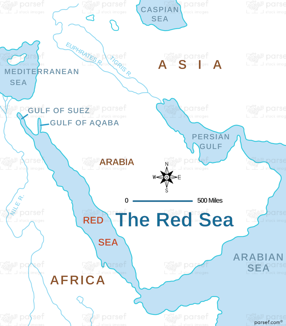
The Red Sea Map: Focusing on the Red Sea, this map highlights its geographical features and surrounding regions. It is useful for understanding the strategic and economic significance of this body of water in antiquity.
The Red Sea Map: Focusing on the Red Sea, this map highlights its geographical features and surrounding regions. It is useful for understanding the strategic and economic significance of this body of water in antiquity.
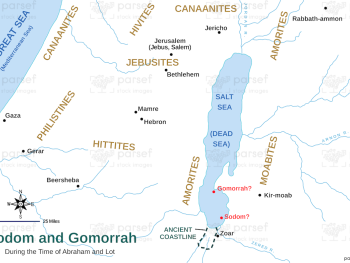
Genesis Sodom and Gomorrah Map: Illustrating the locations of Sodom and Gomorrah according to the Genesis narrative, this map highlights...
Read More
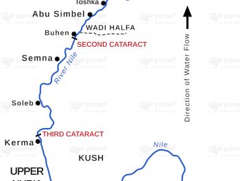
Ancient Nubia Map: This map depicts the region of ancient Nubia, including significant cities and geographical features. Nubia is notable...
Read More
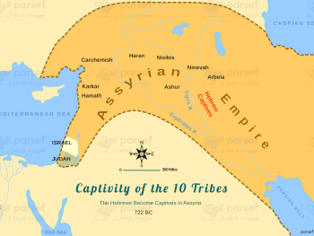
Color map Captivity of the 10 Tribes, the Hebrews Become Captives in Assyria. This one also depicts the locations of the...
Read More
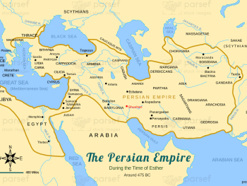
Persian Empire around 475 BC Map: Depicting the Persian Empire around 475 BC, this map shows its vast territorial extent...
Read More
David and Solomon’s Empire Map
This map illustrates the extent of the united kingdom of Israel under the reigns of Kings...
Read More
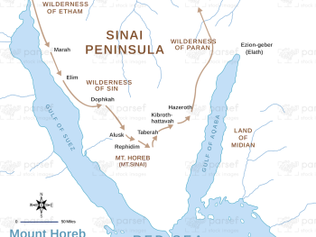
Exodus Mount Horeb Map: This map shows the route to Mount Horeb (Sinai) during the Exodus, highlighting key locations and...
Read More
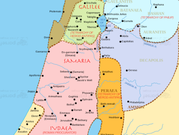
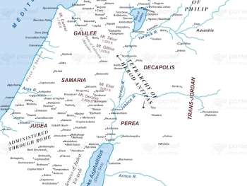
Divisions of Herod’s Kingdom Map
This map illustrates the territorial divisions of Herod the Great's kingdom, highlighting the various regions and...
Read More
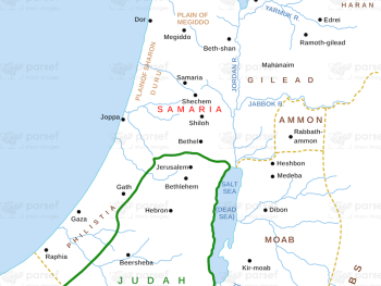
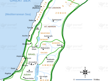
Samaria and Nearby Territories Map: This map illustrates the region of Samaria and its neighboring territories, highlighting significant locations and...
Read More
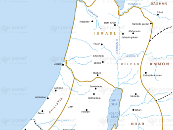
Israel and Judah in the Days of the Kings: Similar to the previous maps, this one depicts the kingdoms of...
Read More
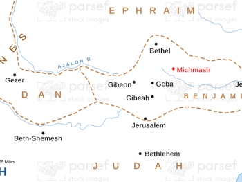
Michmash Map: This map shows the location and significance of Michmash, a key site in the battles between the Israelites...
Read More
Israel in New Testament Times – 1st Century CE – Basic Map – 300Dpi: This map shows Israel during the...
Read More
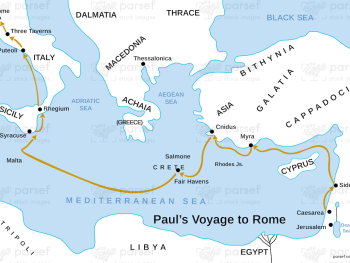
Acts Paul’s Voyage to Rome Map: Depicting the route of Paul’s voyage to Rome, this map highlights significant locations and...
Read More