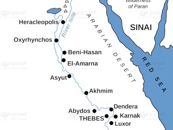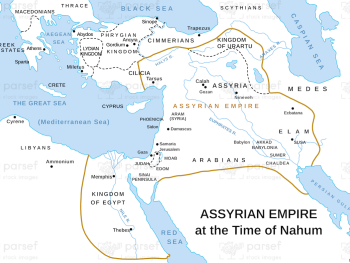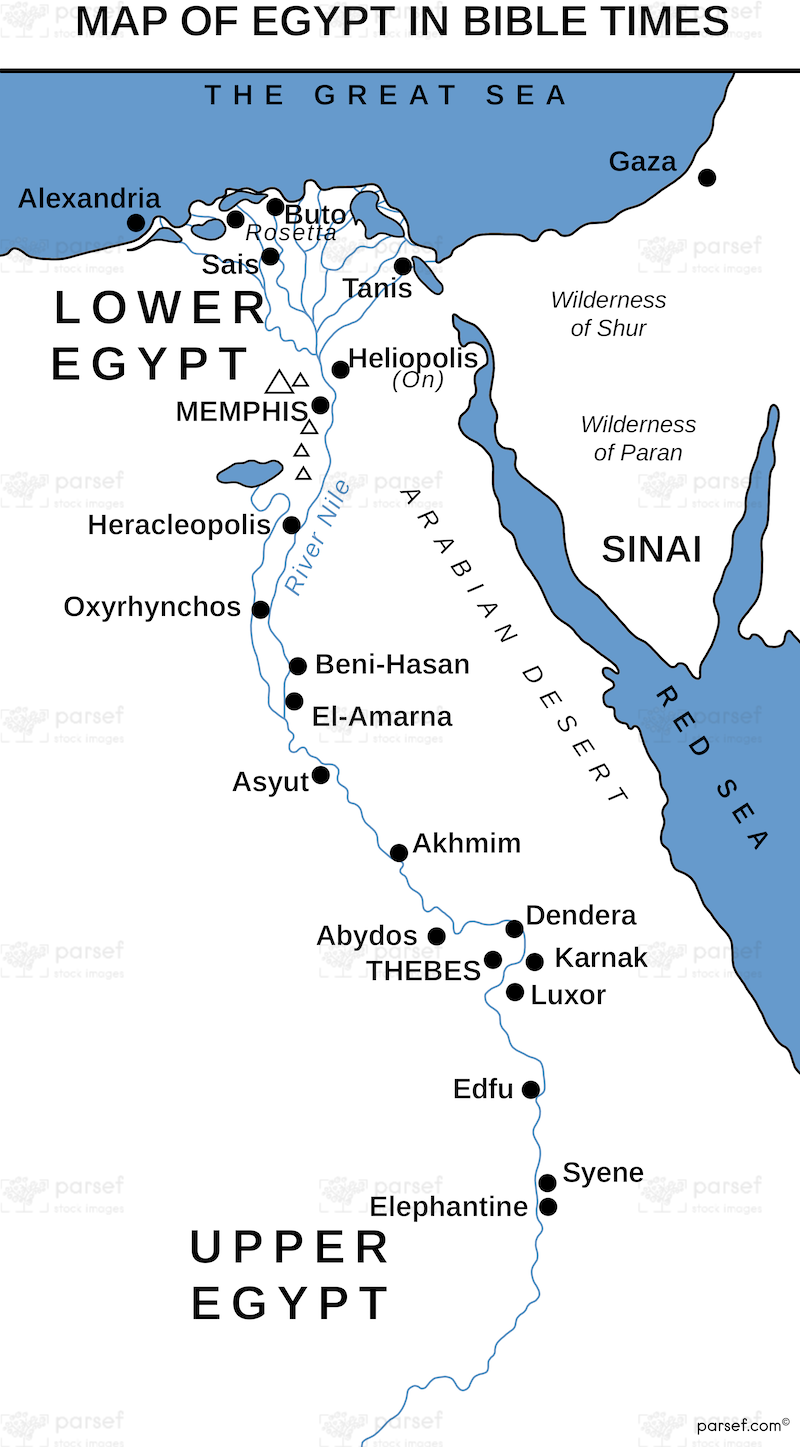

Egypt in Bible Times Map
- This map provides a comprehensive overview of the geography of ancient Egypt, highlighting key cities, regions, and geographical features mentioned in the Bible.
- It offers a visual understanding of the historical and geographical context of the Israelites' sojourn in Egypt.
- The map may include features such as the Nile River, the Delta region, and significant pharaonic sites.
Download High Resolution 300 DPI File Egypt in Bible Times Map